

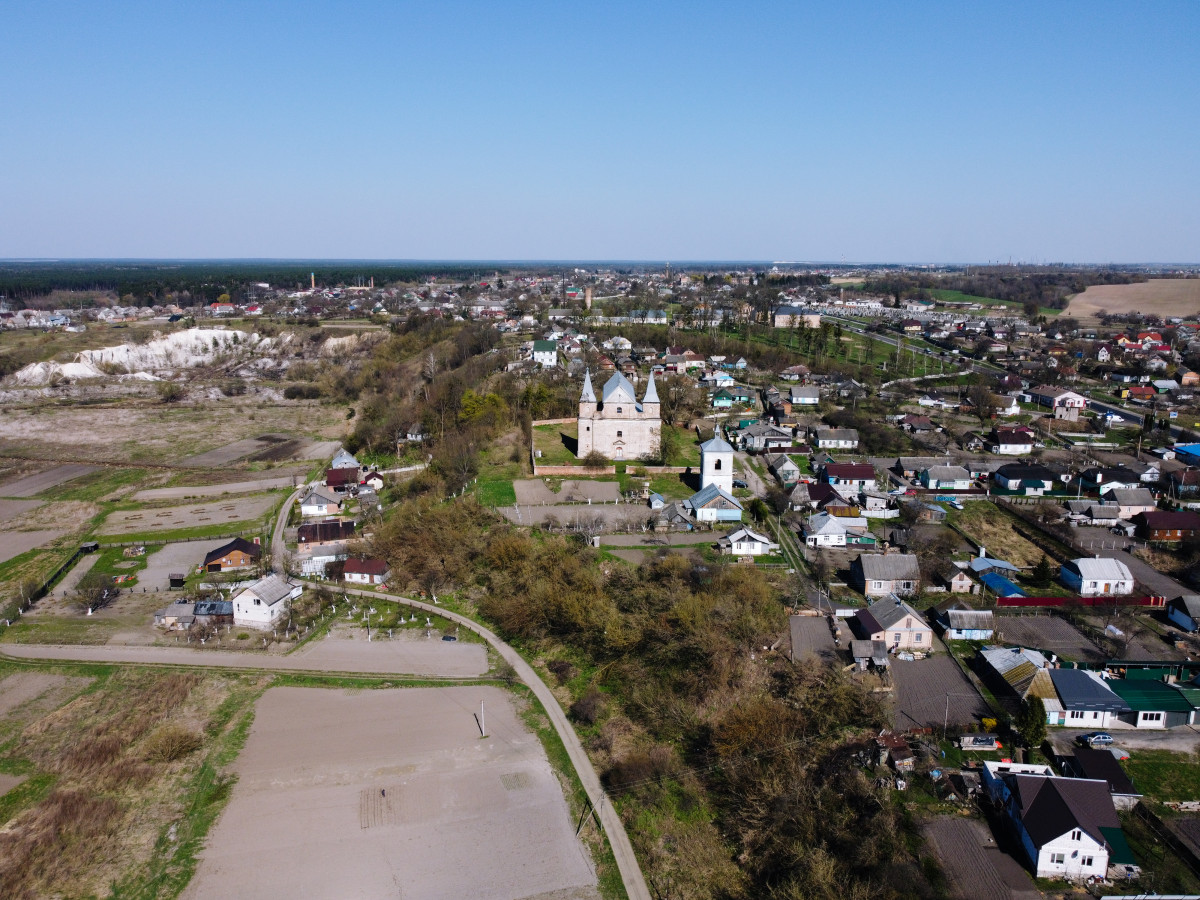
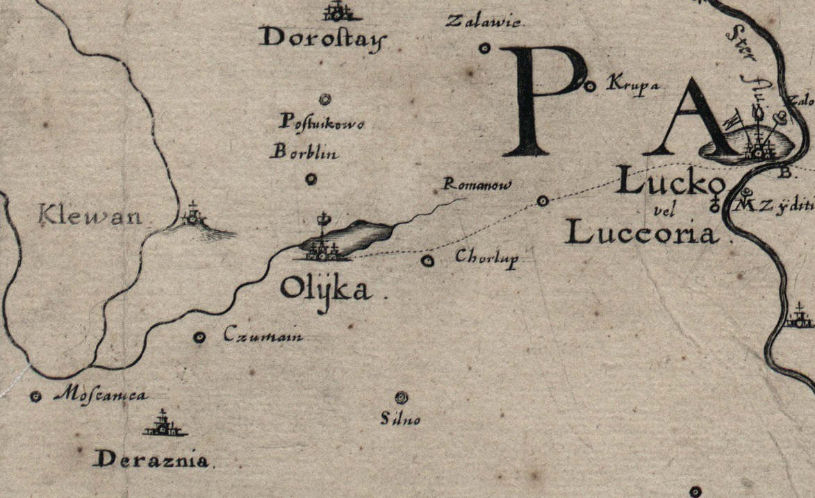
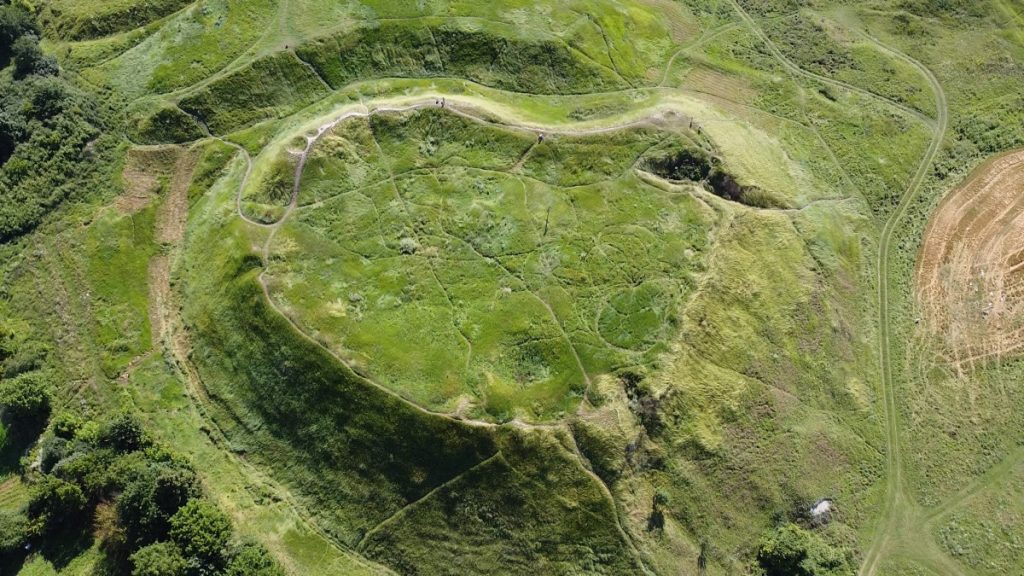
Ancient princely town, located on a high promontory above the river Stubla, the former residence of the Czartoryski family.
The ruins of a medieval castle and other architectural sites of national significance are reminiscent of its centuries-old history.
The town was first mentioned in written sources in 1458, but historians claim that it existed as early as the twelfth century under the name of Kolyvan.
After the decline of princely Peresopnytsia, Klevan grew and became an important political and economic center of south-eastern Volyn.
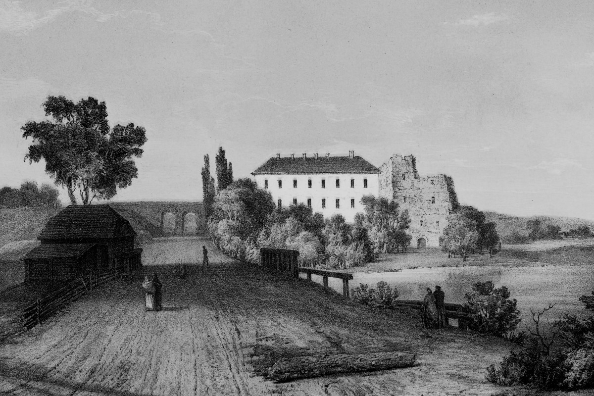
In the XV century Klevan belonged to the Lithuanian-Rus duke Svydryhailo (Švitrigaila) Gedyminovych, who transferred it to the ownership of prince Mykhailo Czartoryski, and in 1475 he built a castle on the site of an ancient fortified settlement. Twenty years later, his son, prince Fedir Czartoryski, fortified the castle, surrounded it with strong stone walls and a deep moat.
The fortifications also surrounded the cathedral in the north, the synagogues in the east and the church of St. Nicholas in the west.
In 1654 Klevan received the Magdeburg right; it actively developed as a market town.
In 1704 it ceased to be the residence of the Czartoryski family and gradually began to decline. After their departure, Jesuit monks settled in the castle and lived there until 1773.
In 1817 the castle was rebuilt for the needs of the gymnasium. After its transfer to Lutsk, several other educational institutions worked here, and since 1877 – a seminary.
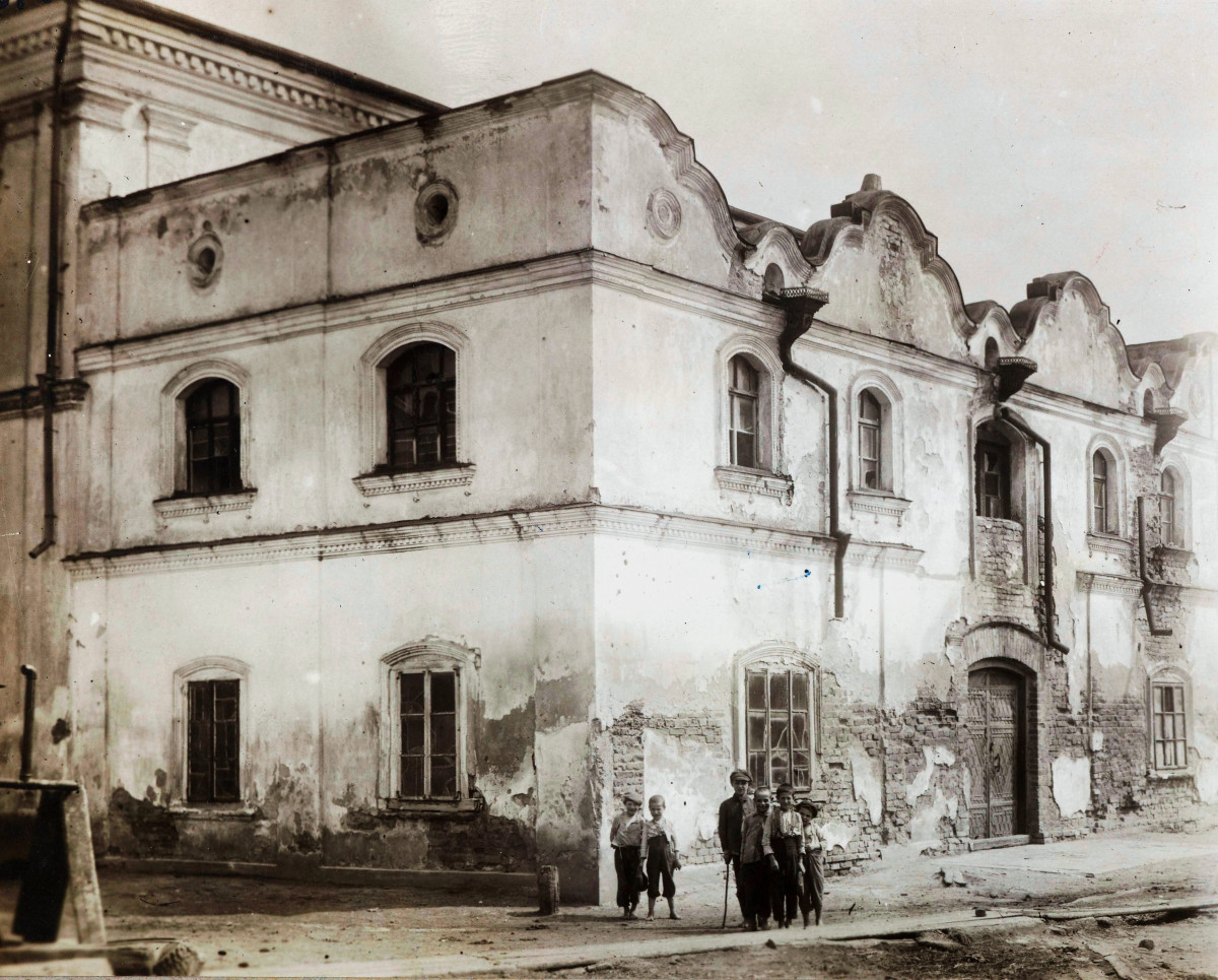
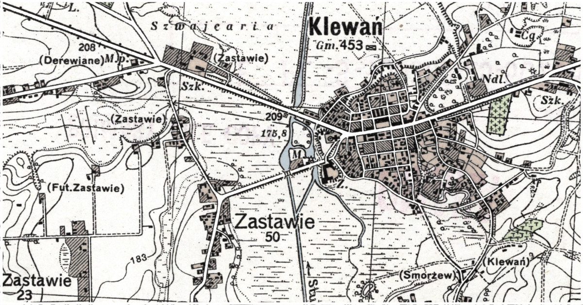
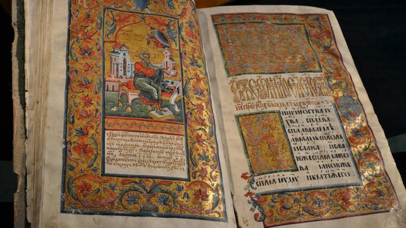
The town had the following suburbs: Klevanska Yurydyka and Zastavie. According to the 1911 census, Klevan had 4,230 inhabitants, a hospital and a shelter, a pharmacy and a doctor, 93 shops, 1 bookstore, a water mill, an inn, a cooperative, 12 fairs a year, 2 alcohol shops, a town hall, a city council, a post office and a telegraph, a court, a state-owned estate, a paramedic station, and a brick synagogue in the Renaissance style.
The two world wars, the national revolution of 1918-1921, the German and Soviet occupation left their mark on the modern appearance of the town.
Today it is an urban-type settlement with a population of 7,729 people, the center of a united territorial community with convenient transport links. The settlement consists of two zones: Klevan-I – the historical part and Klevan-II – a new area around the railway station, best known for the natural tourist attraction “Tunnel of Love”.
Architectural Sites of National and Local Significance:
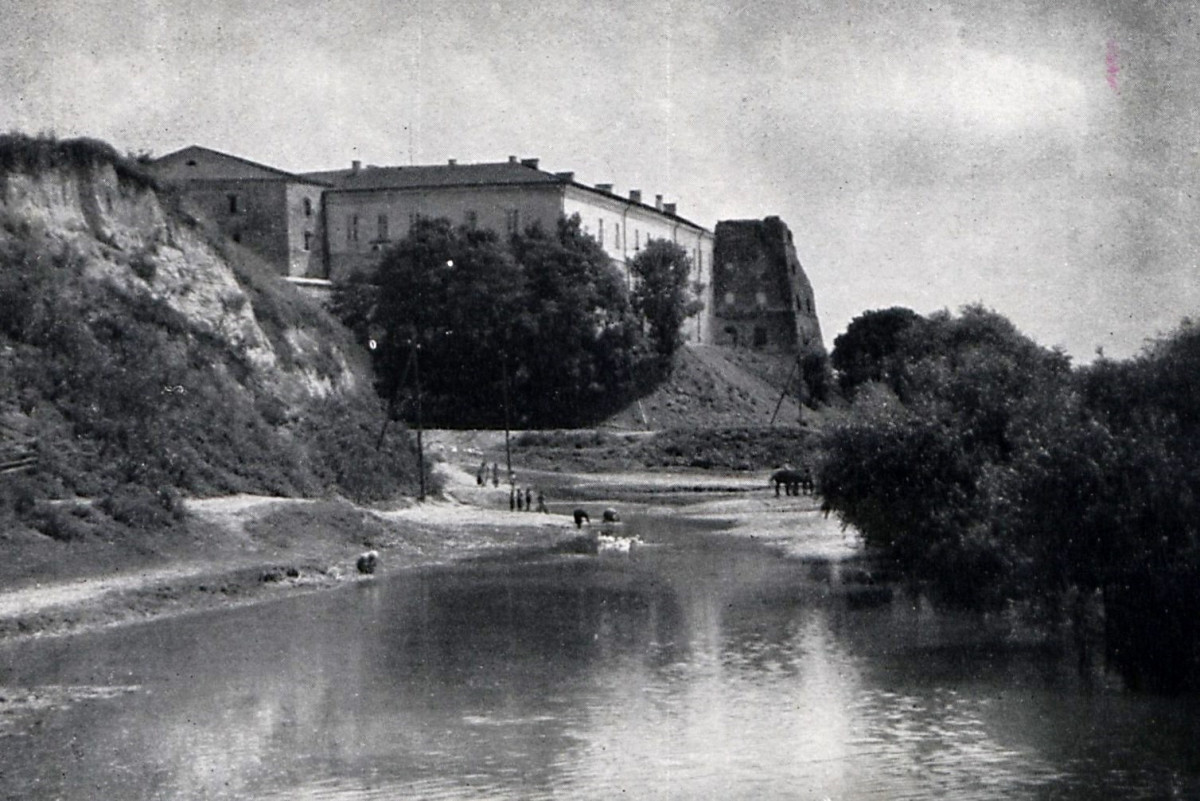
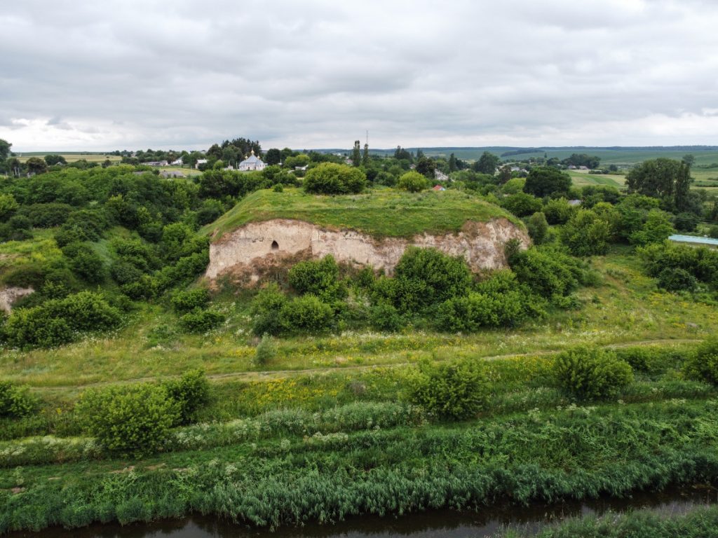
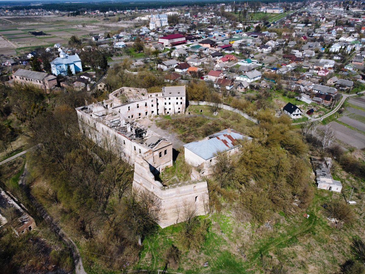
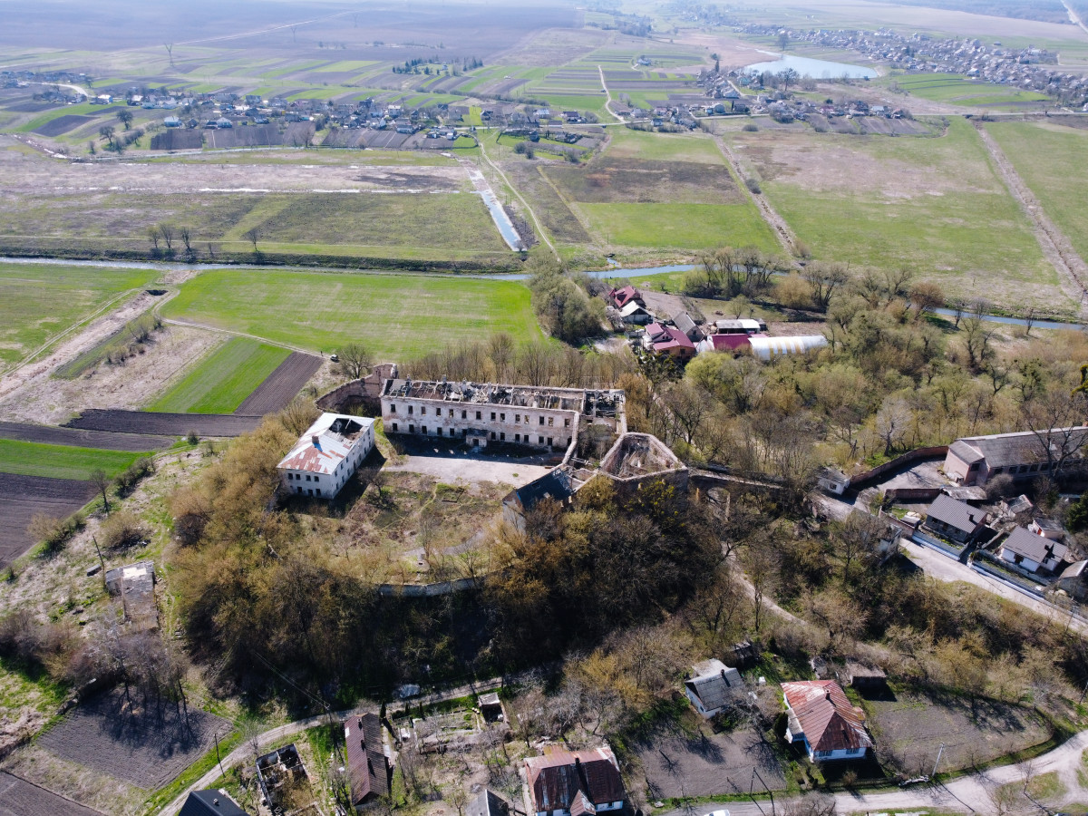
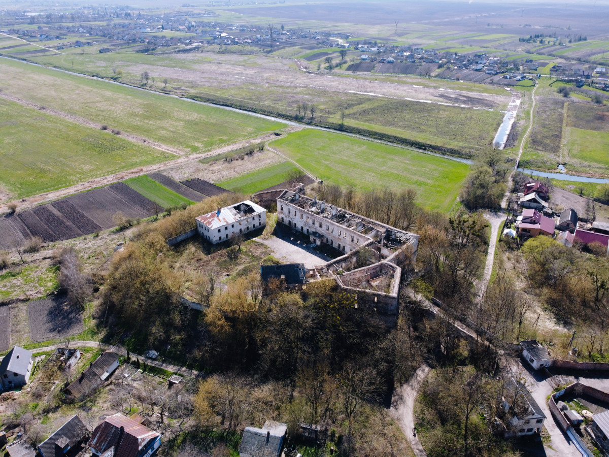
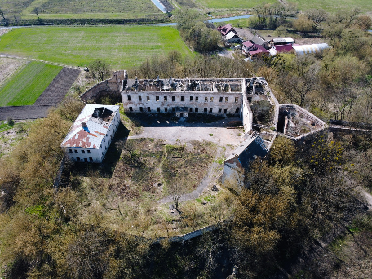
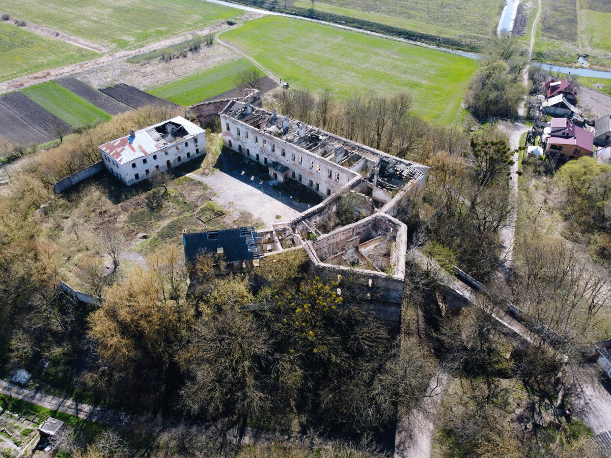
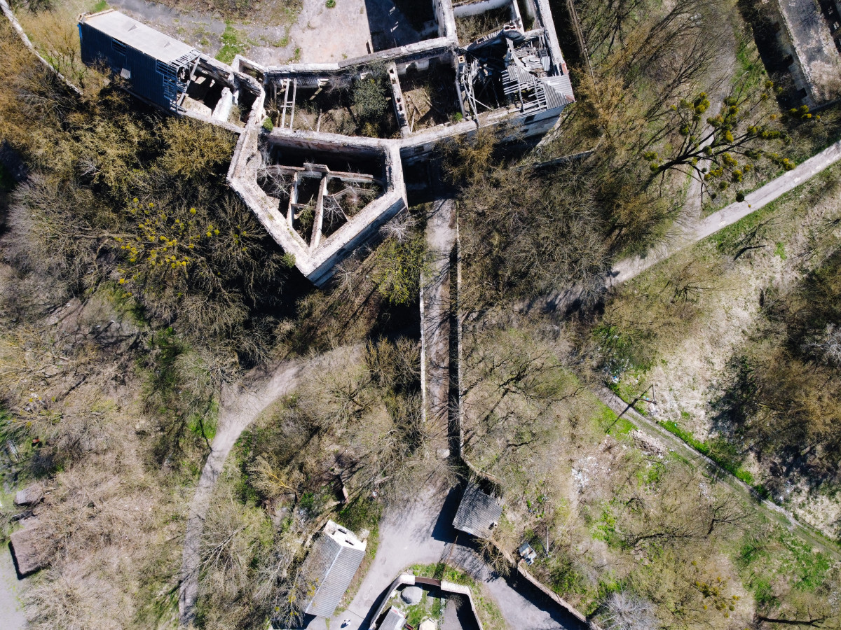
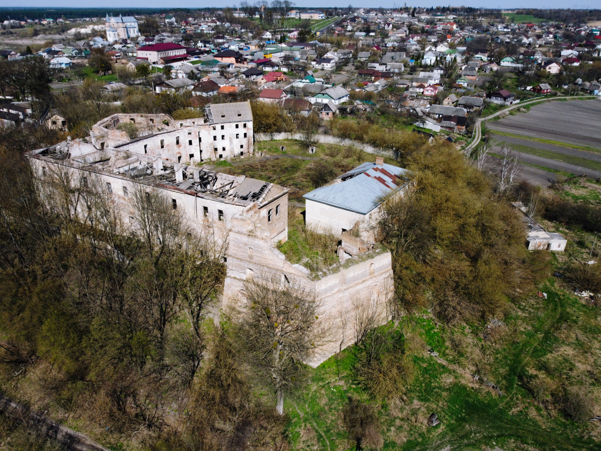
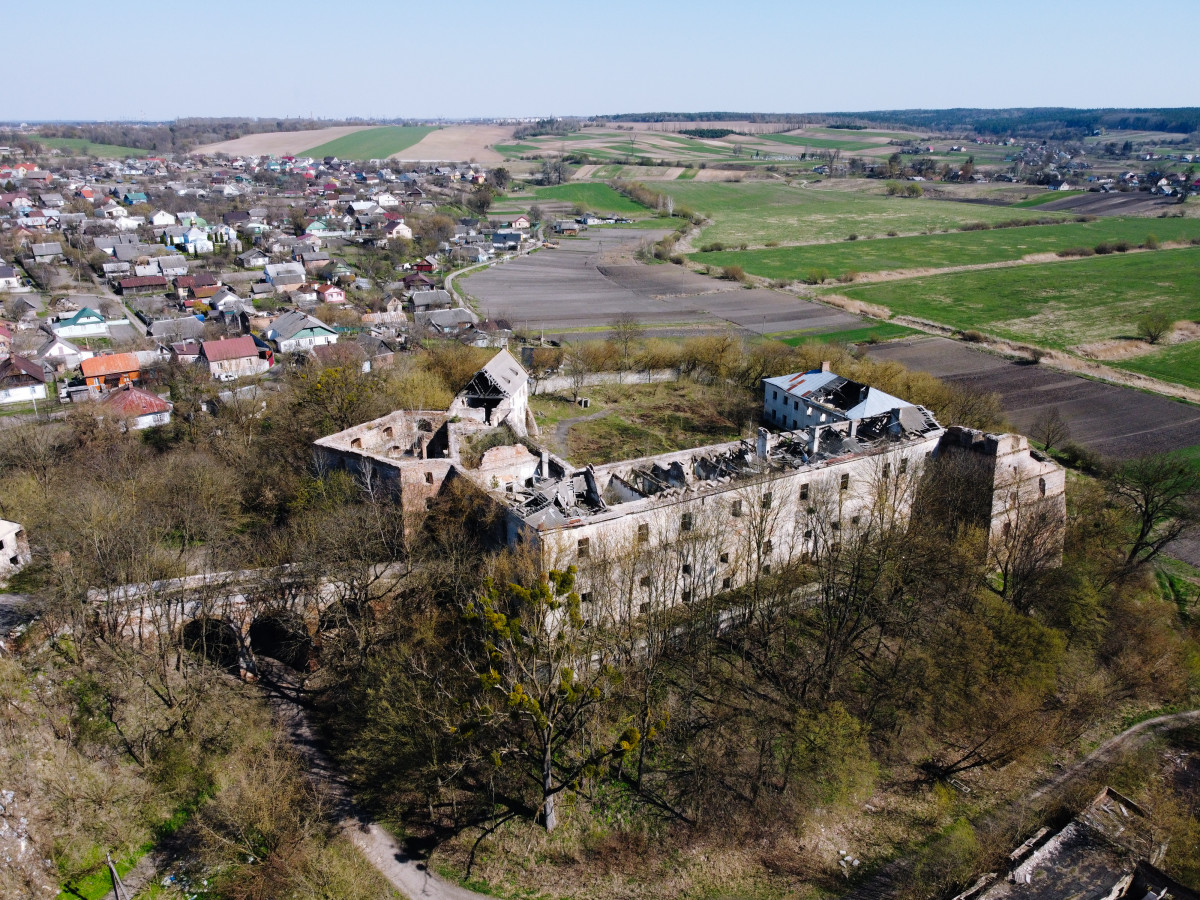
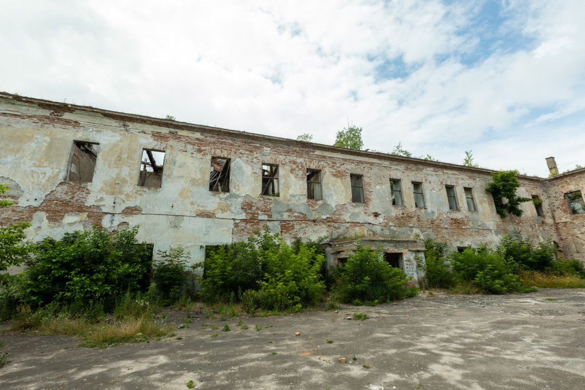
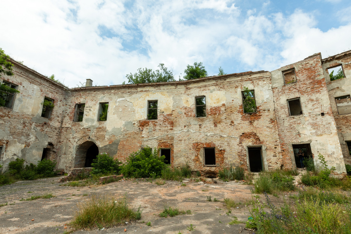
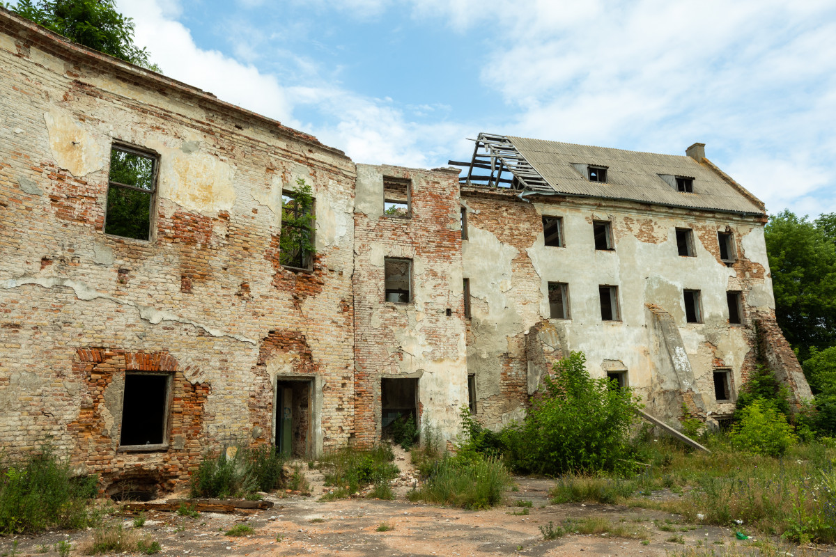
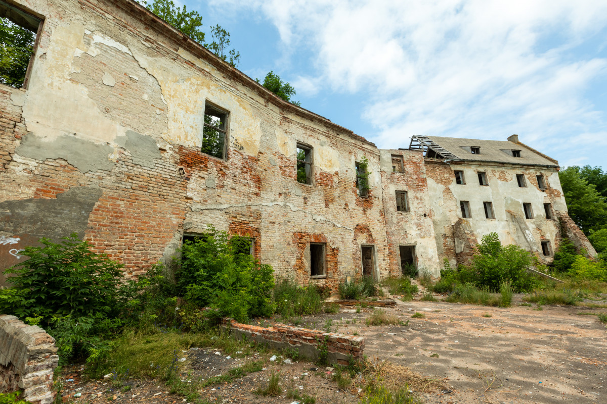
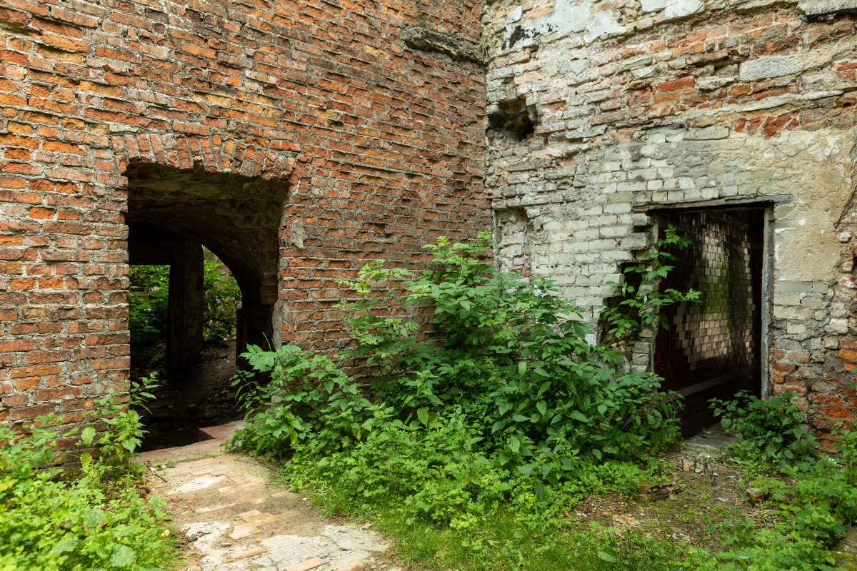
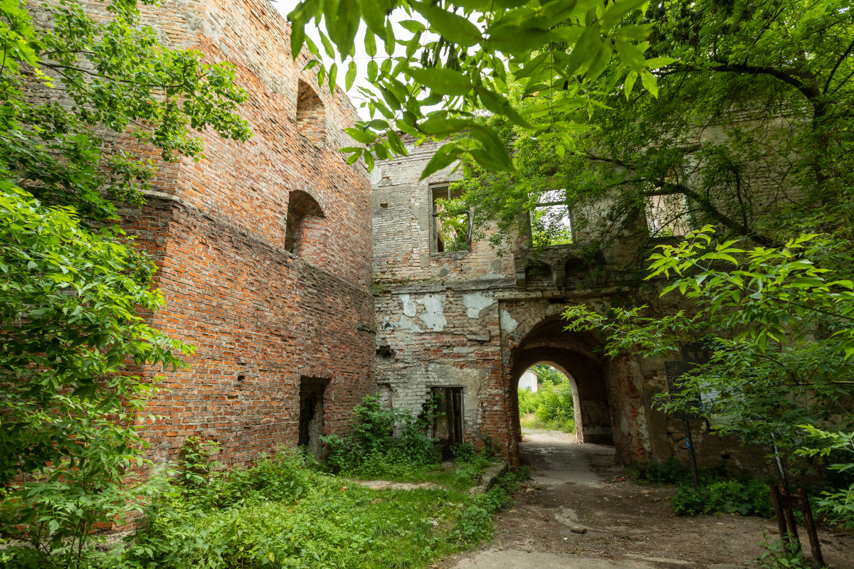
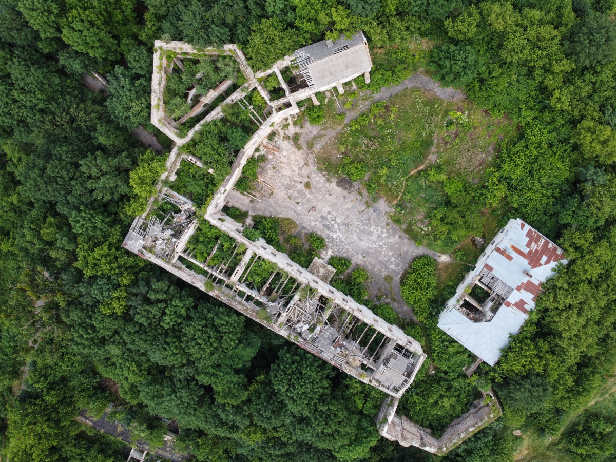
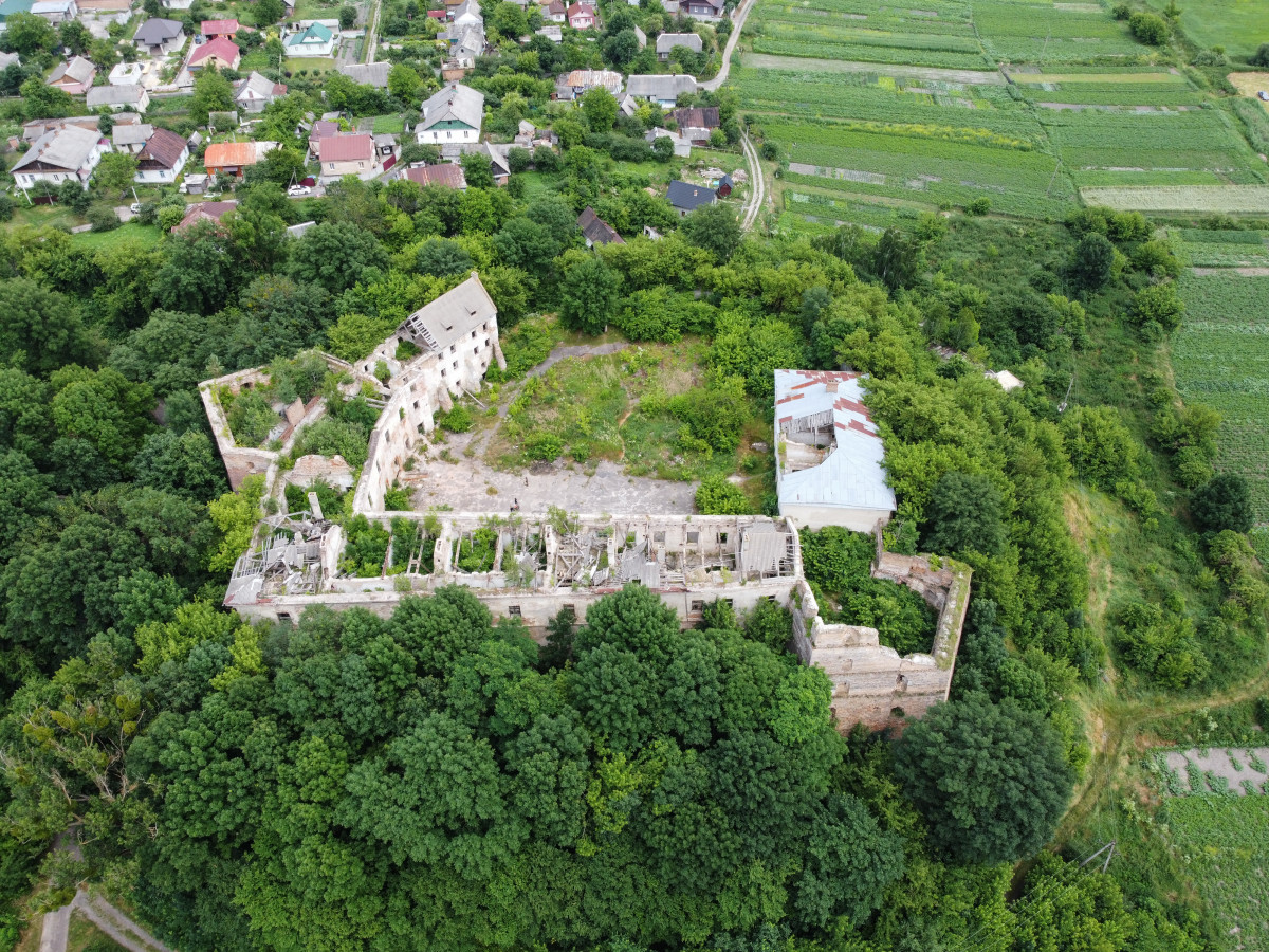
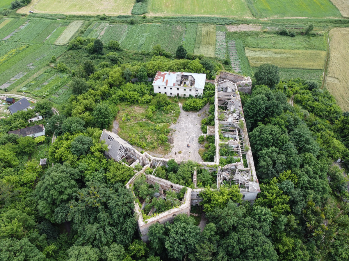
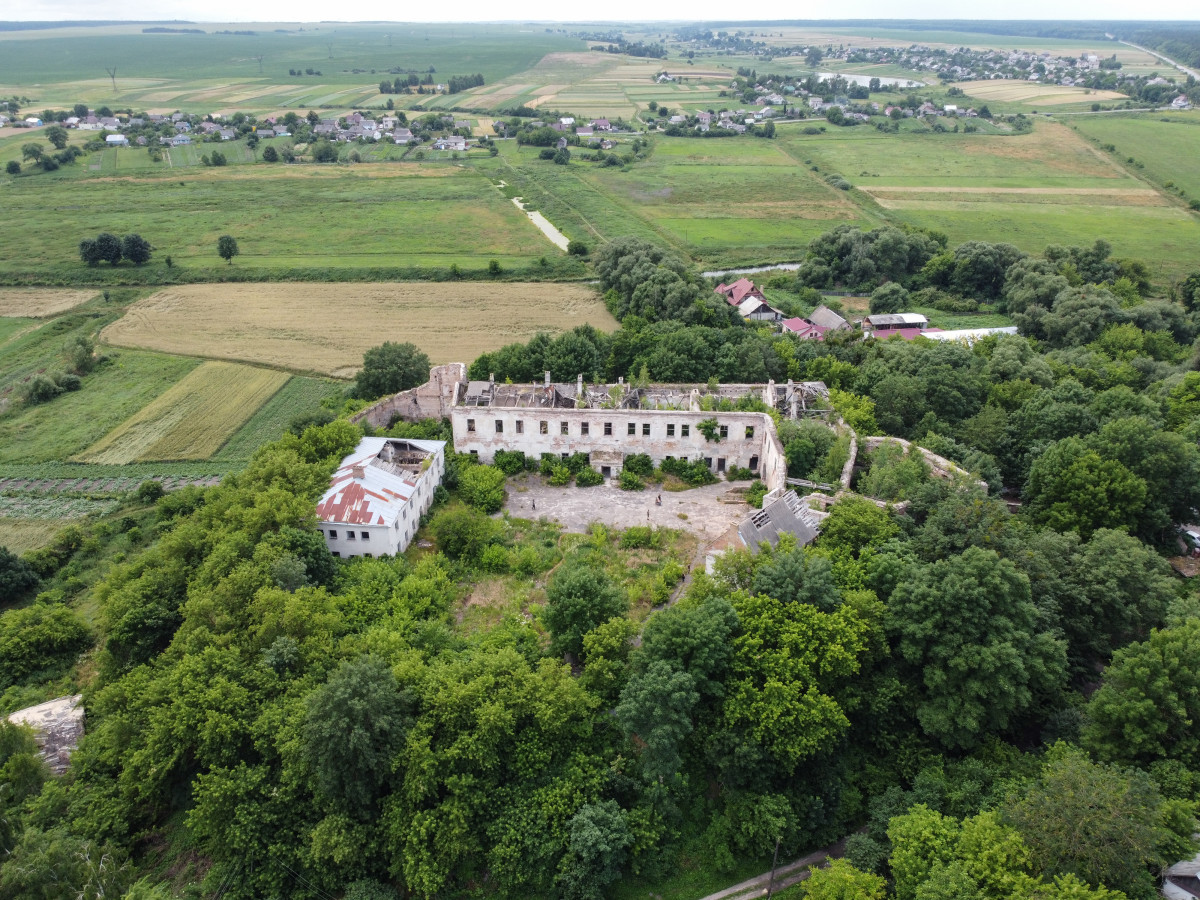
The Klevan Castle
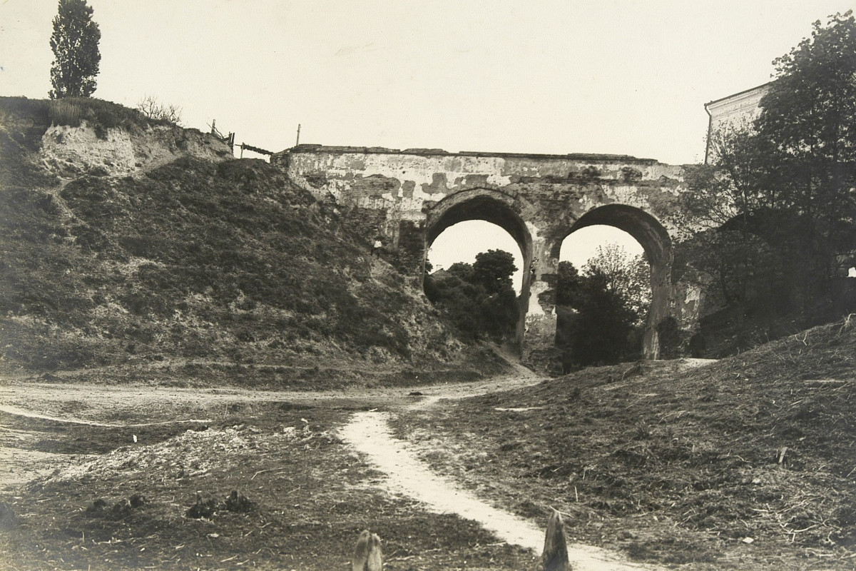
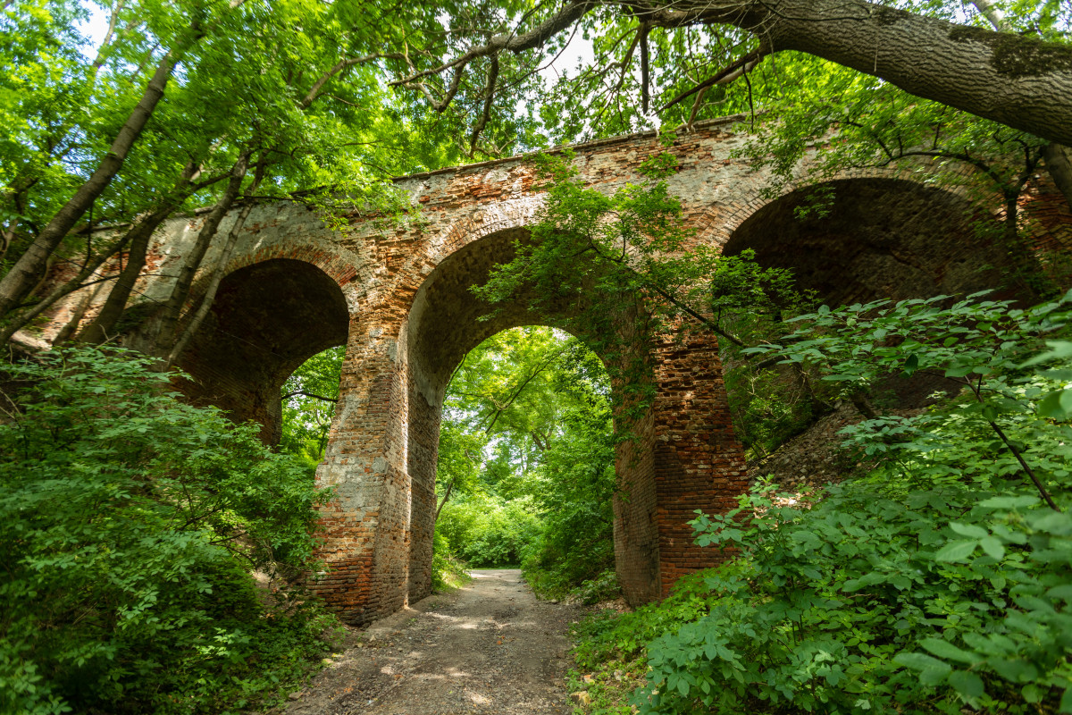
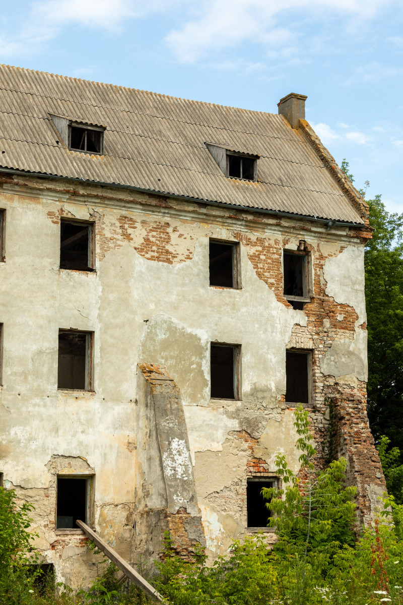
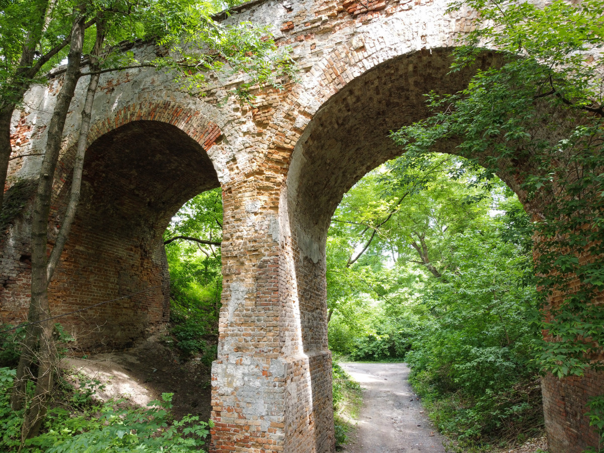
The architectural site of national importance. The Czartoryski family started to build the castle as their own residence in the middle of the XV century and completed in 1561. Today, two rectangular bastion towers and three buildings of the castles are preserved. Its brick walls are 4 meters thick. The entrance to the castle is through the arched bridge that was completed in the XVII century and was decorated with frescoes. The entrance gate has remnants of elements typical for Gothic architecture. As of today, the monument is collapsing and needs significant restoration.
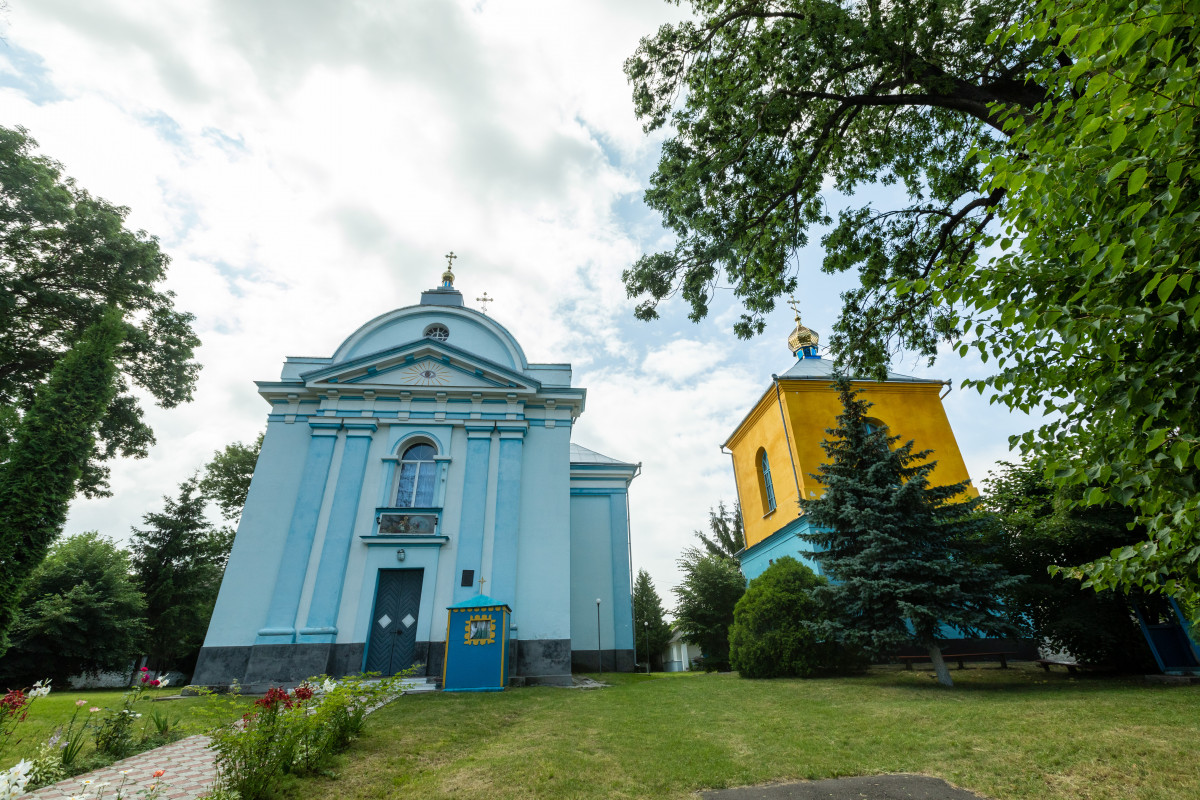
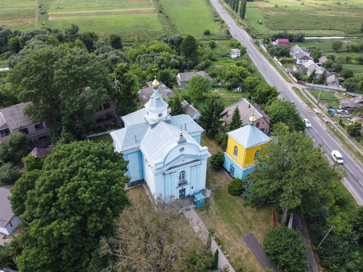
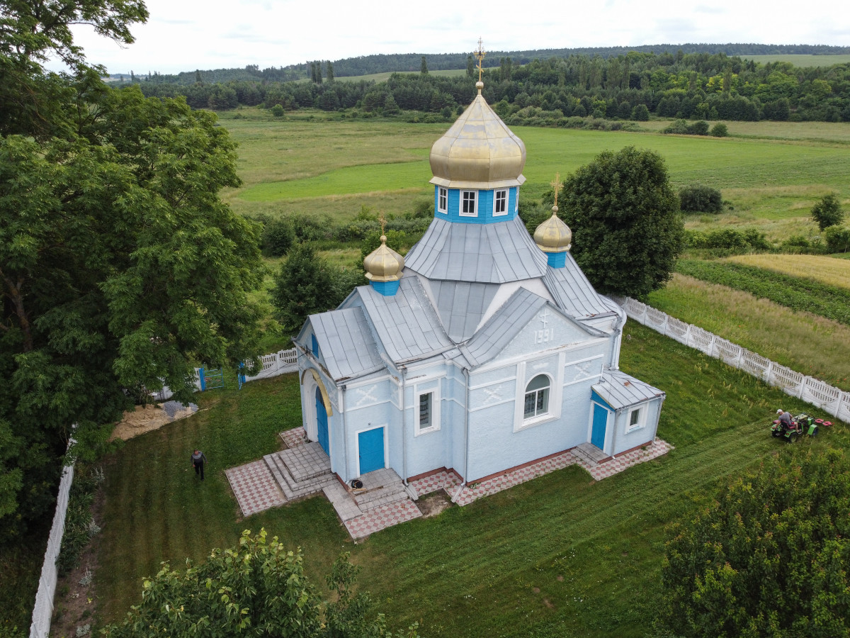
Church of the Nativity
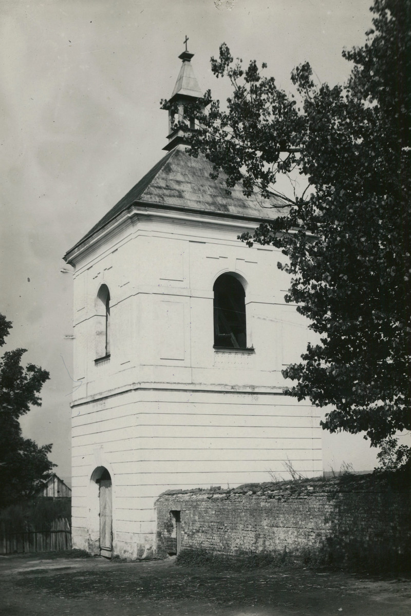
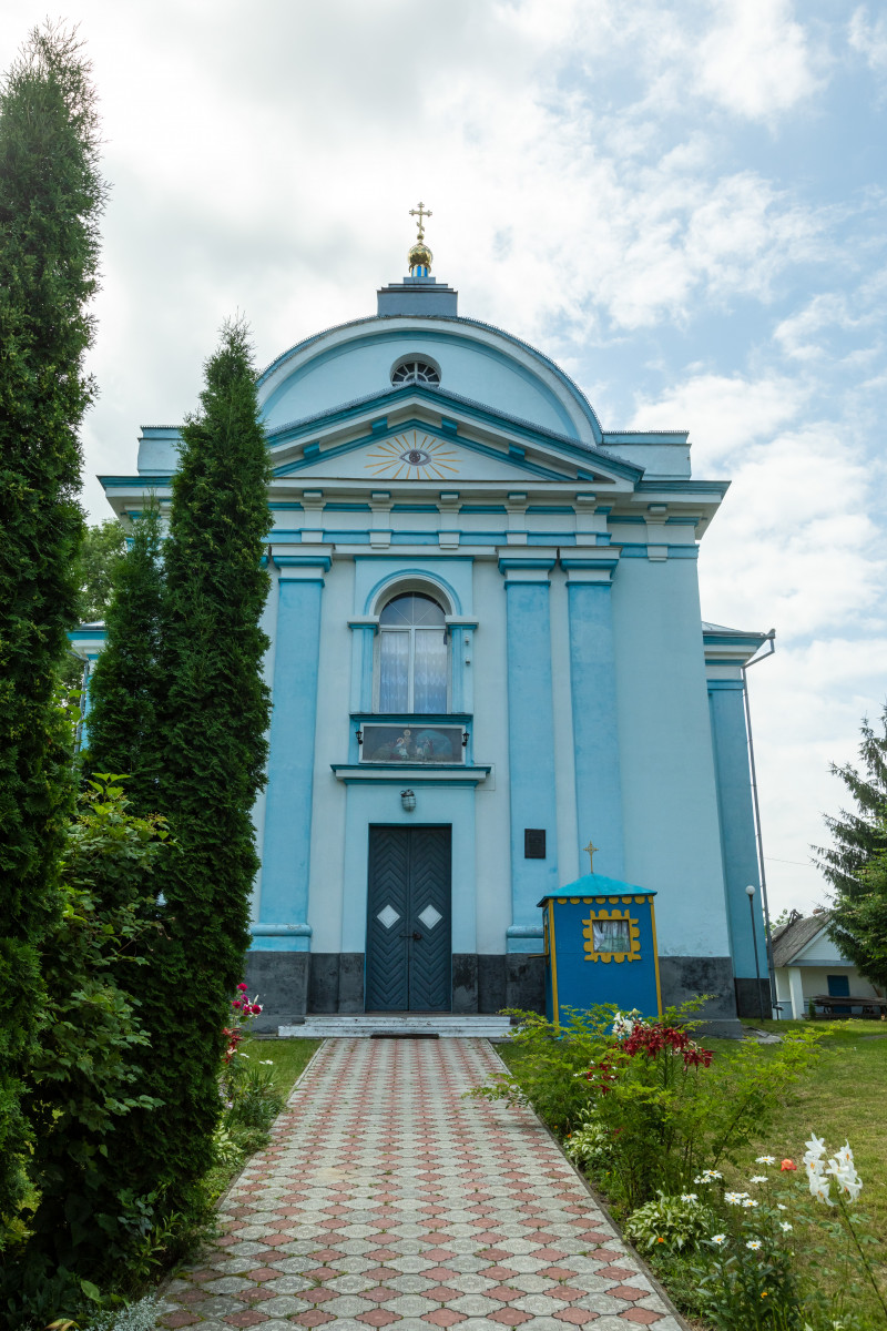
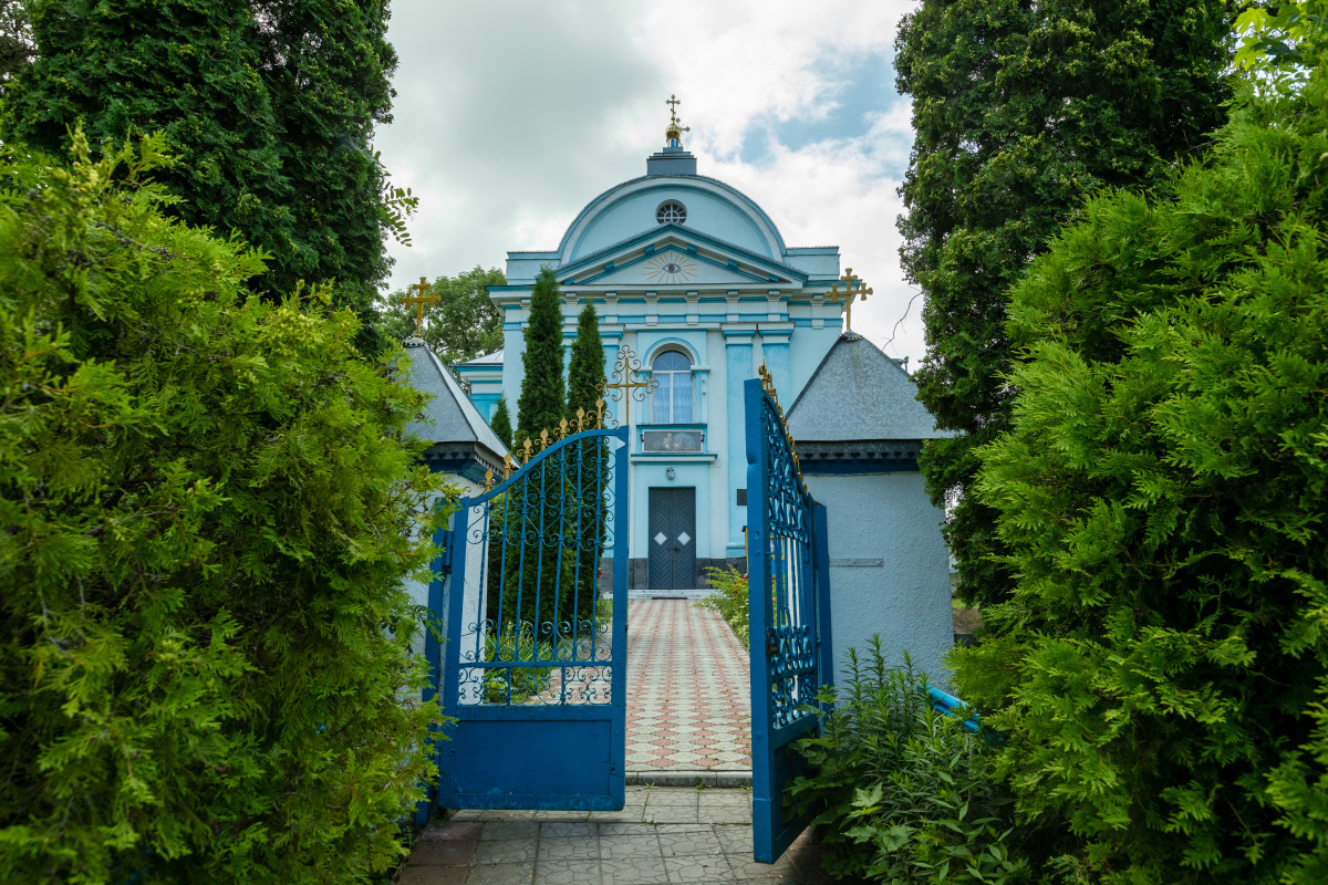
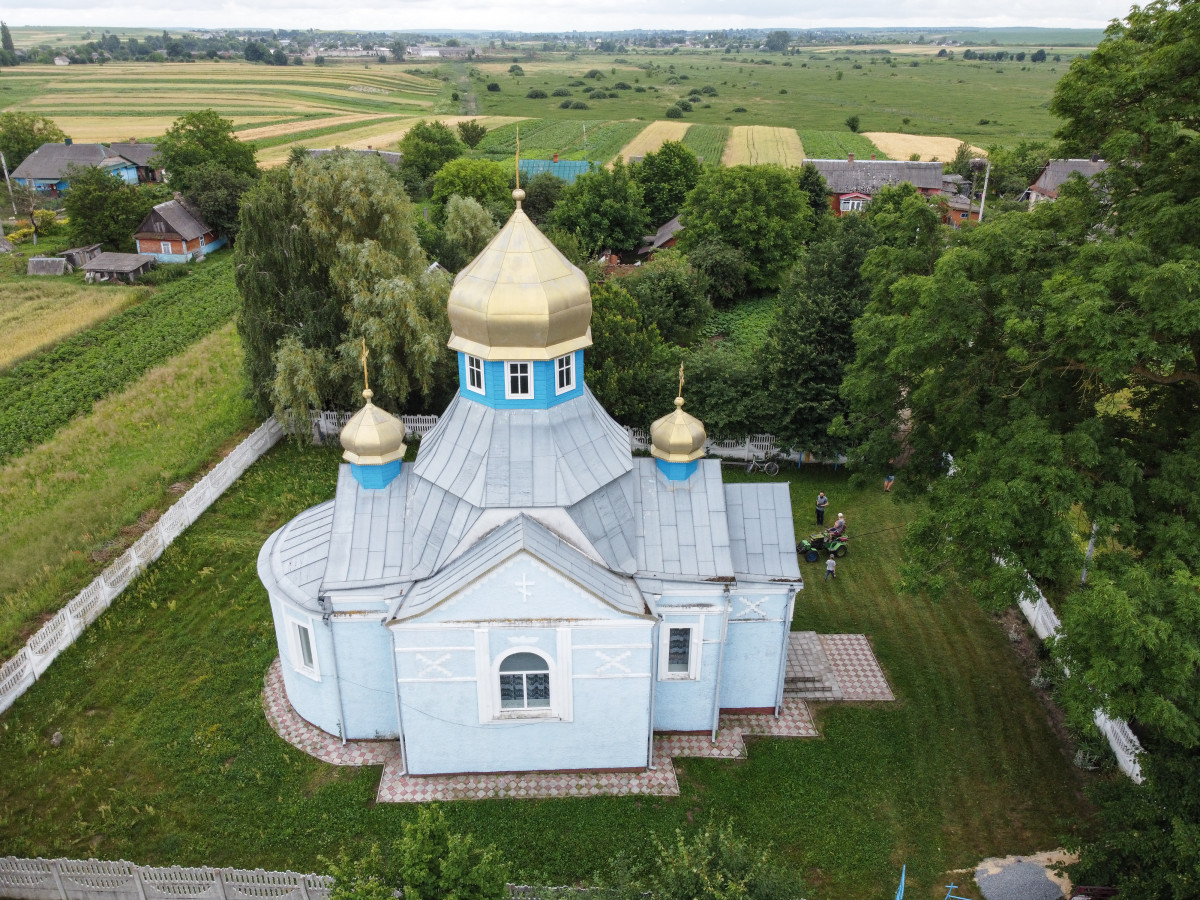
The architectural site of national significance, erected in 1777 in the style of Classicism, as a Greek Catholic church at the expense of prince Adam Czartoryski. The three-dimensional planning of the church is typical for folk architecture. In 1844 a stone bell tower was built, and in 1862 the ceiling of the church was changed and a wooden dome was constructed. The church is decorated with rich paintings.
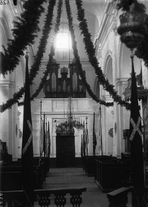
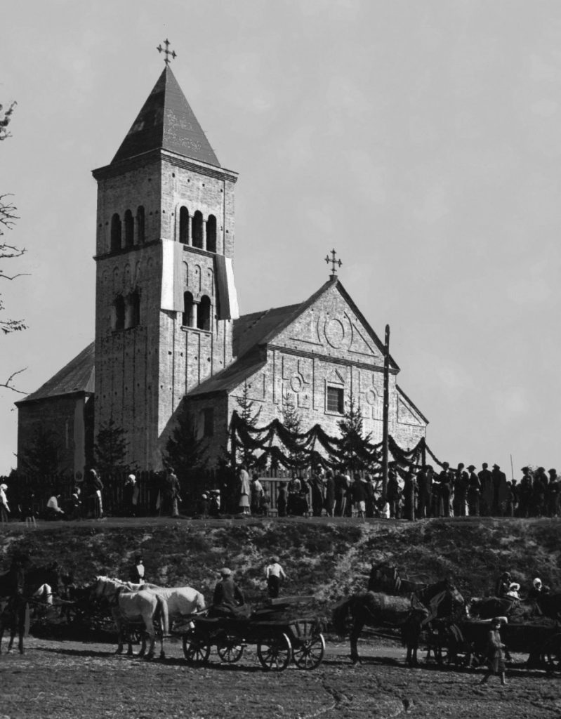
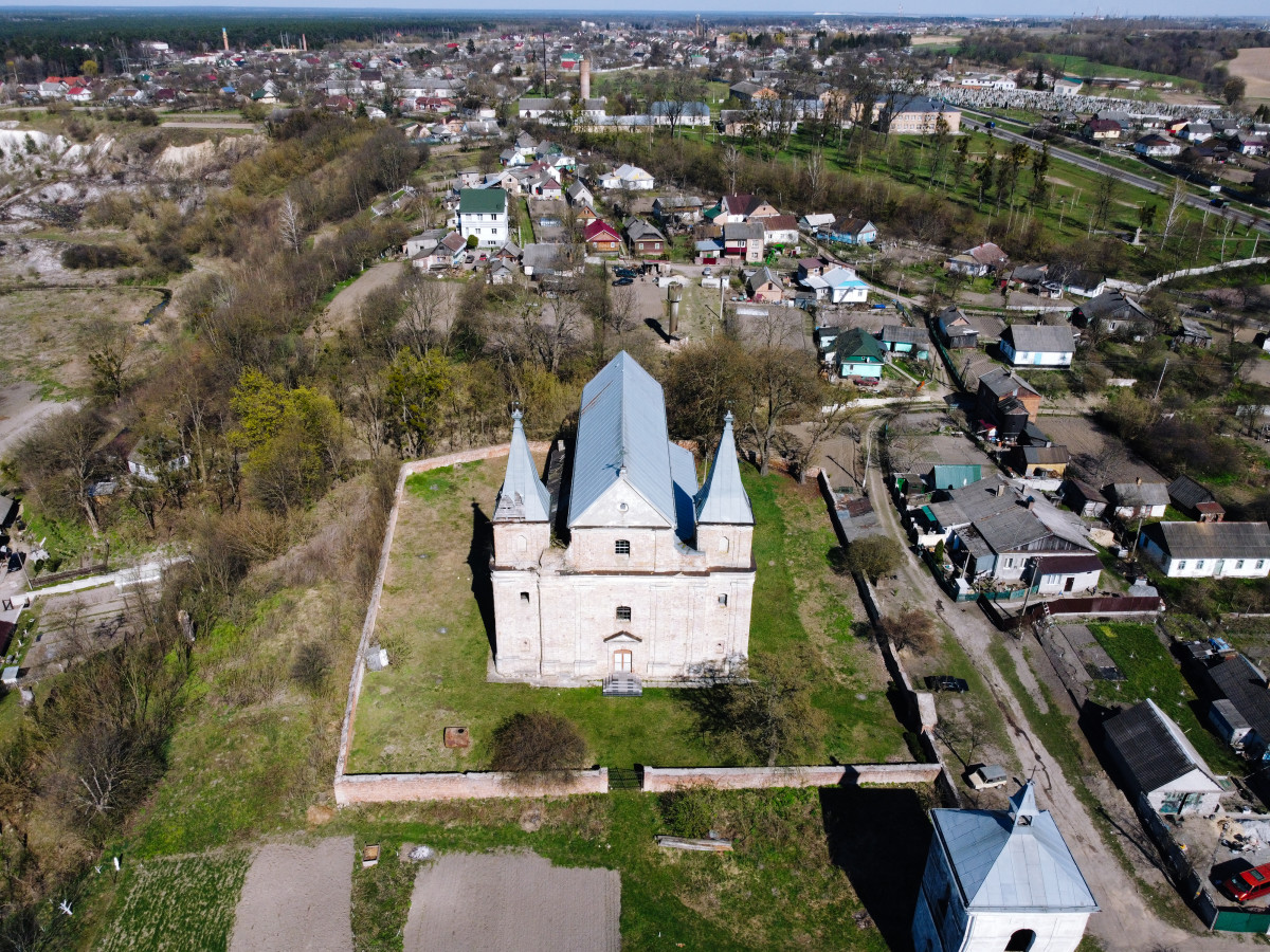
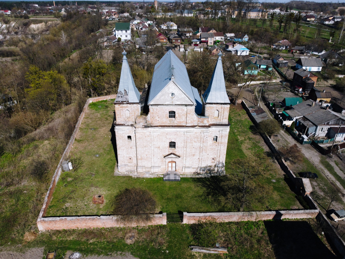
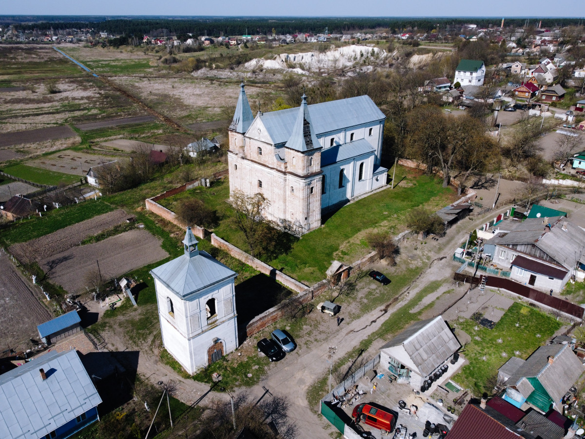
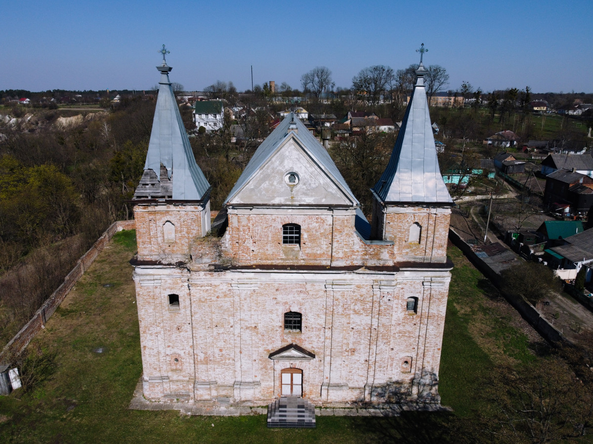
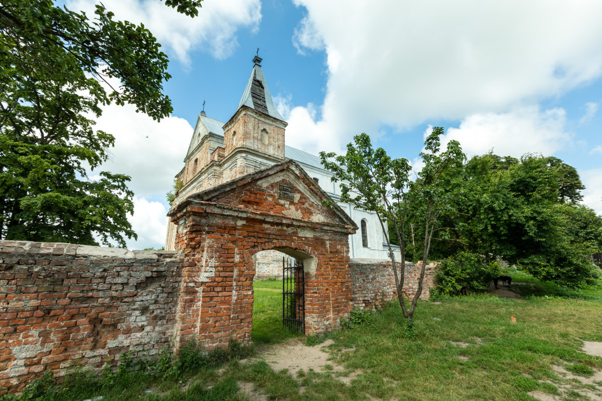
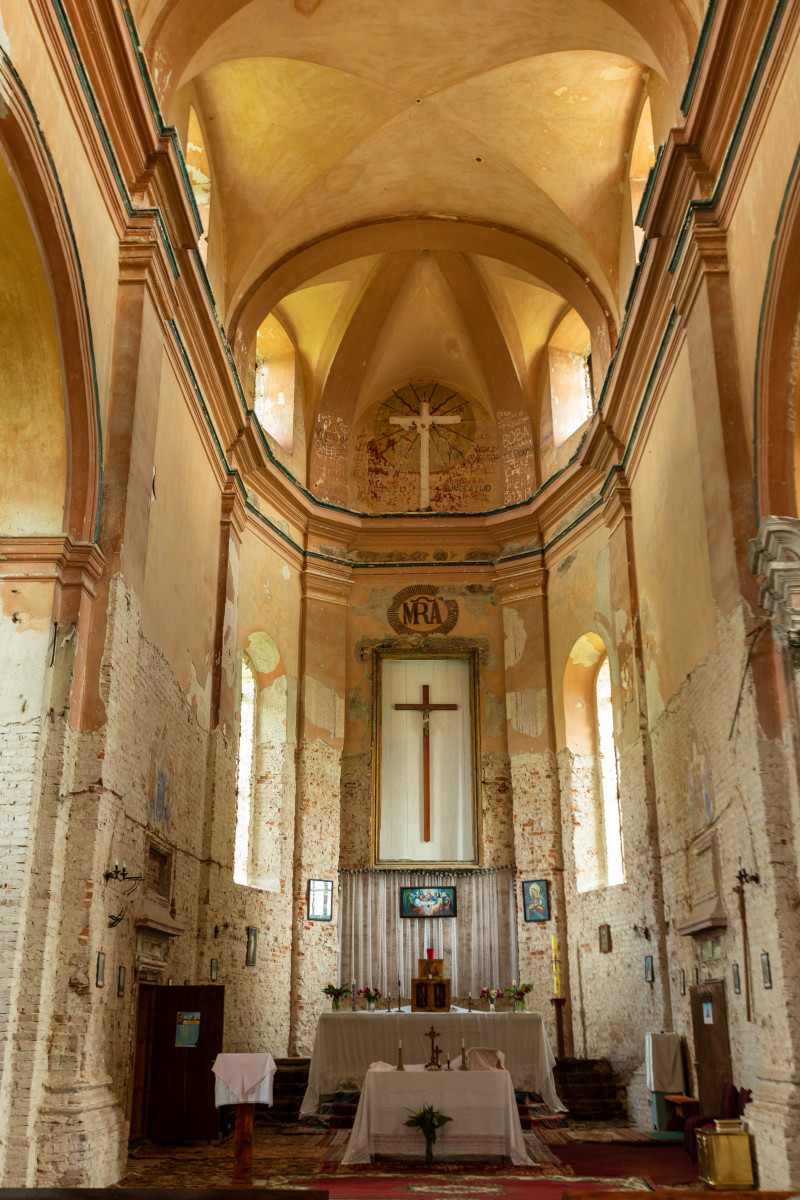
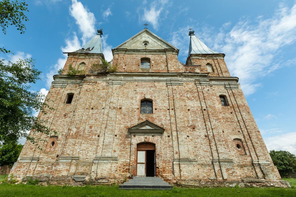
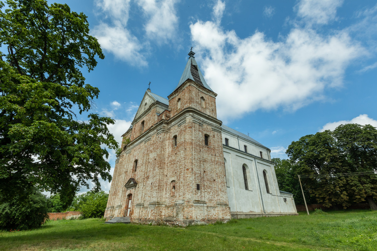
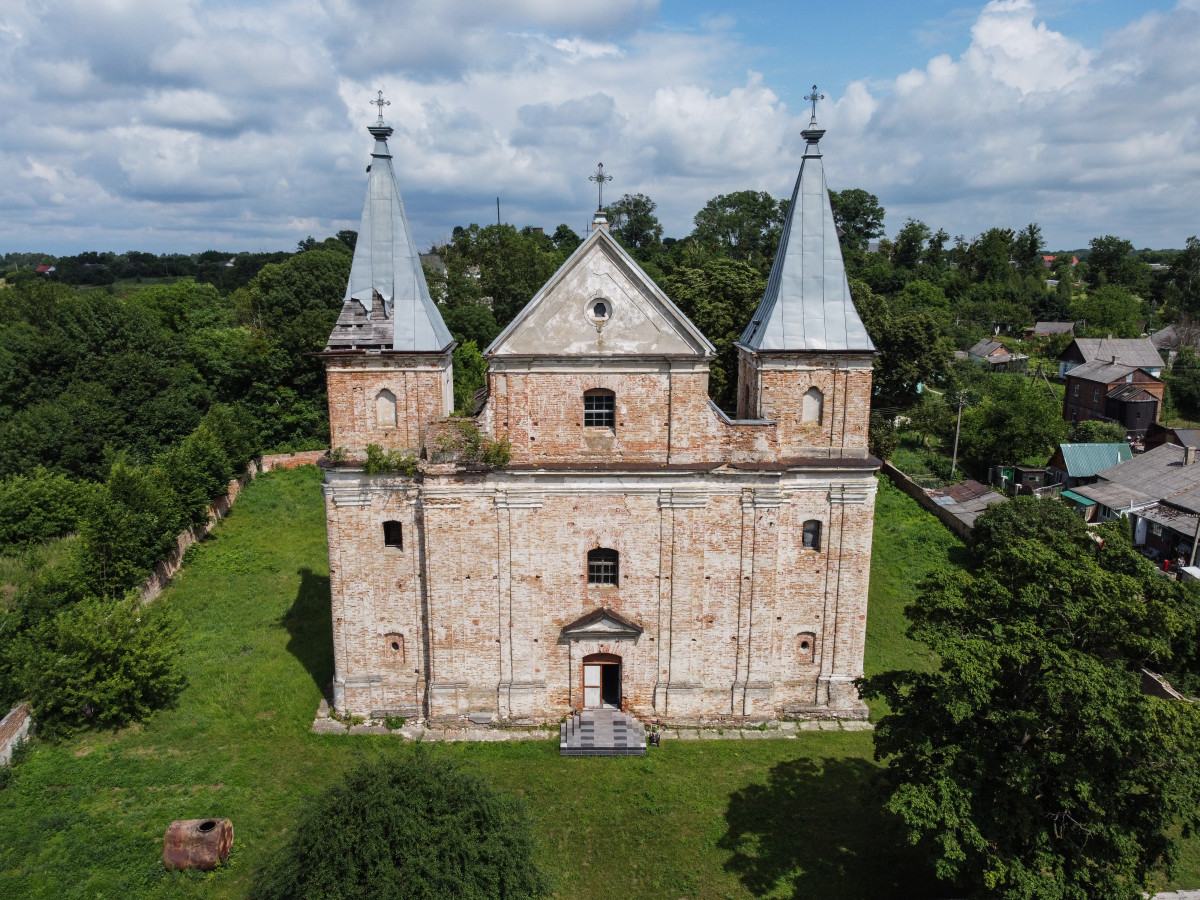
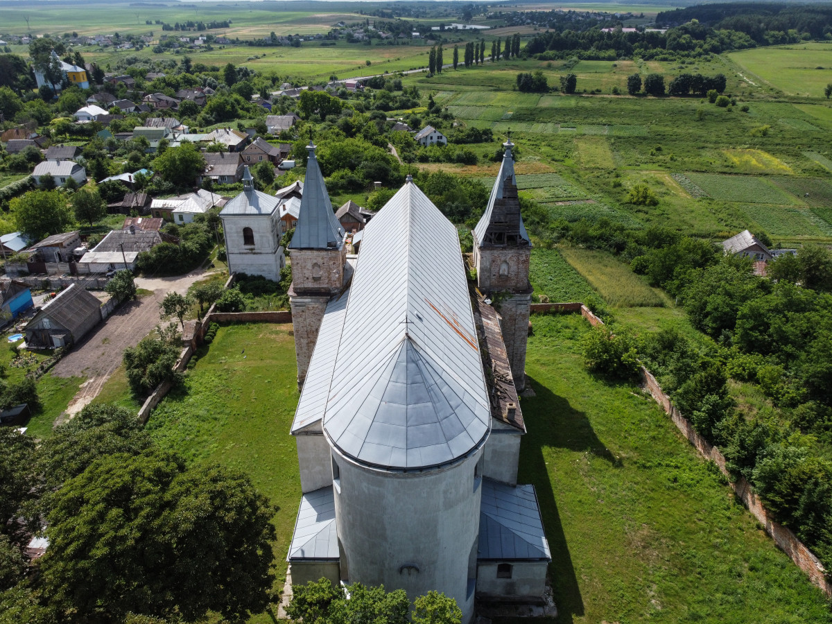
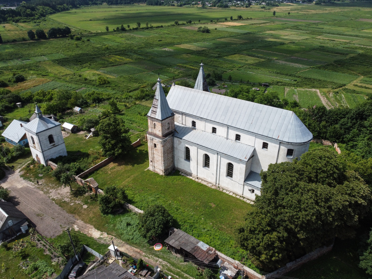
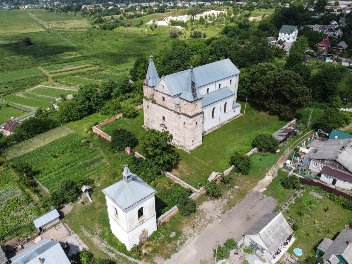
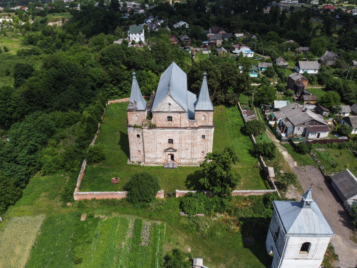
Church of the Annunciation
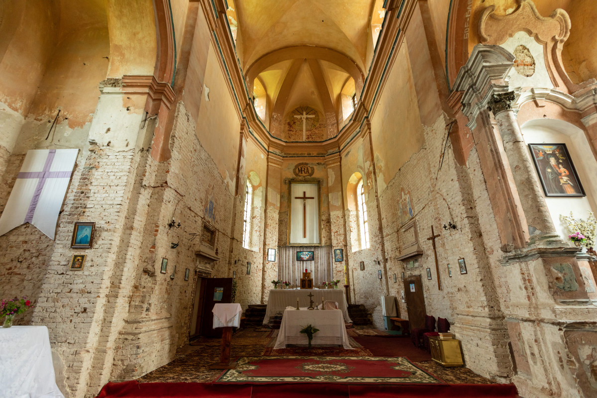
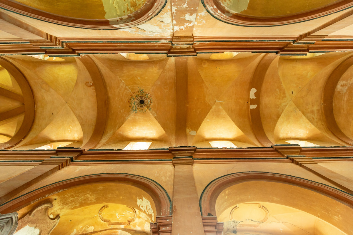
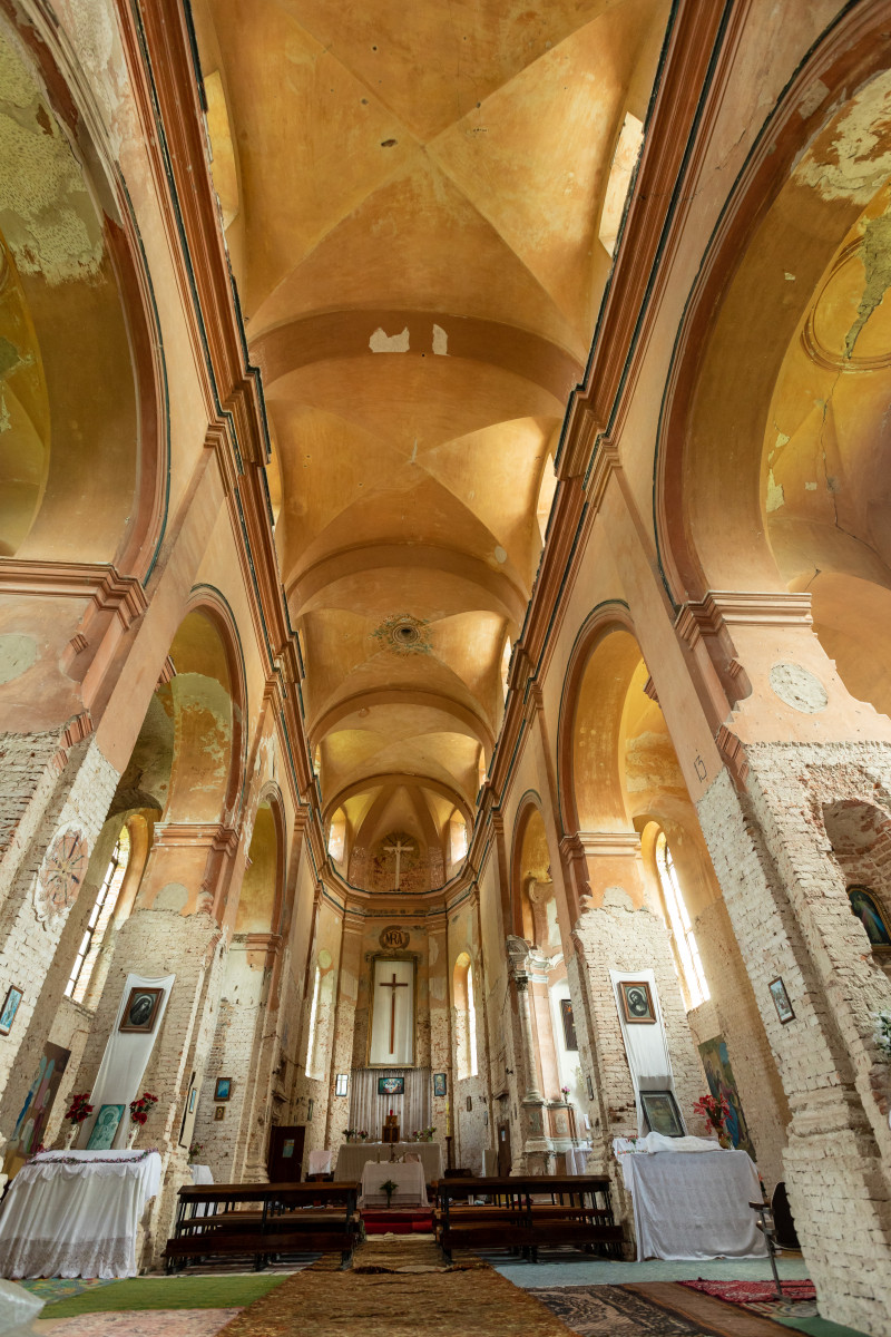
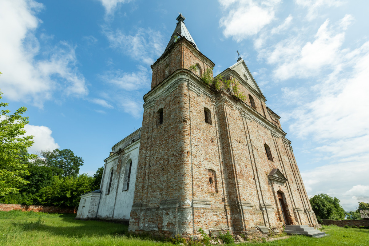
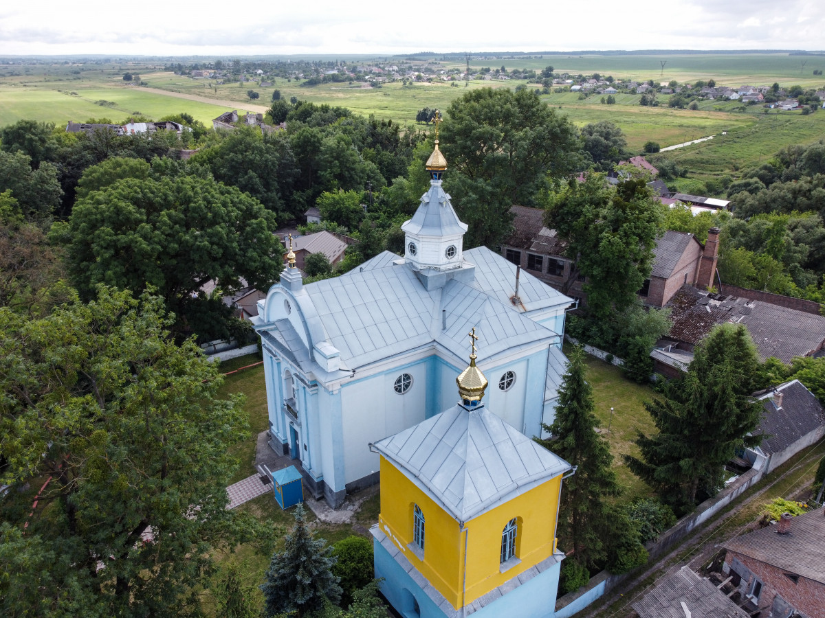
The architectural monument of national significance, built by Yuri Czartoryski in 1610 in the Baroque style on the site of a wooden church. The three-nave basilica is built of brick with two square three-tiered towers on the central facade. To the south, there is a square two-story bell tower and a brick fence with a gate. Until the Second World War, the church was decorated with an altarpiece of the Klevan Mother of God, created by the Italian artist Carlo Dolci.